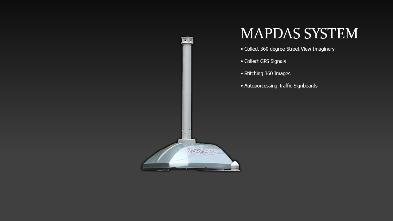
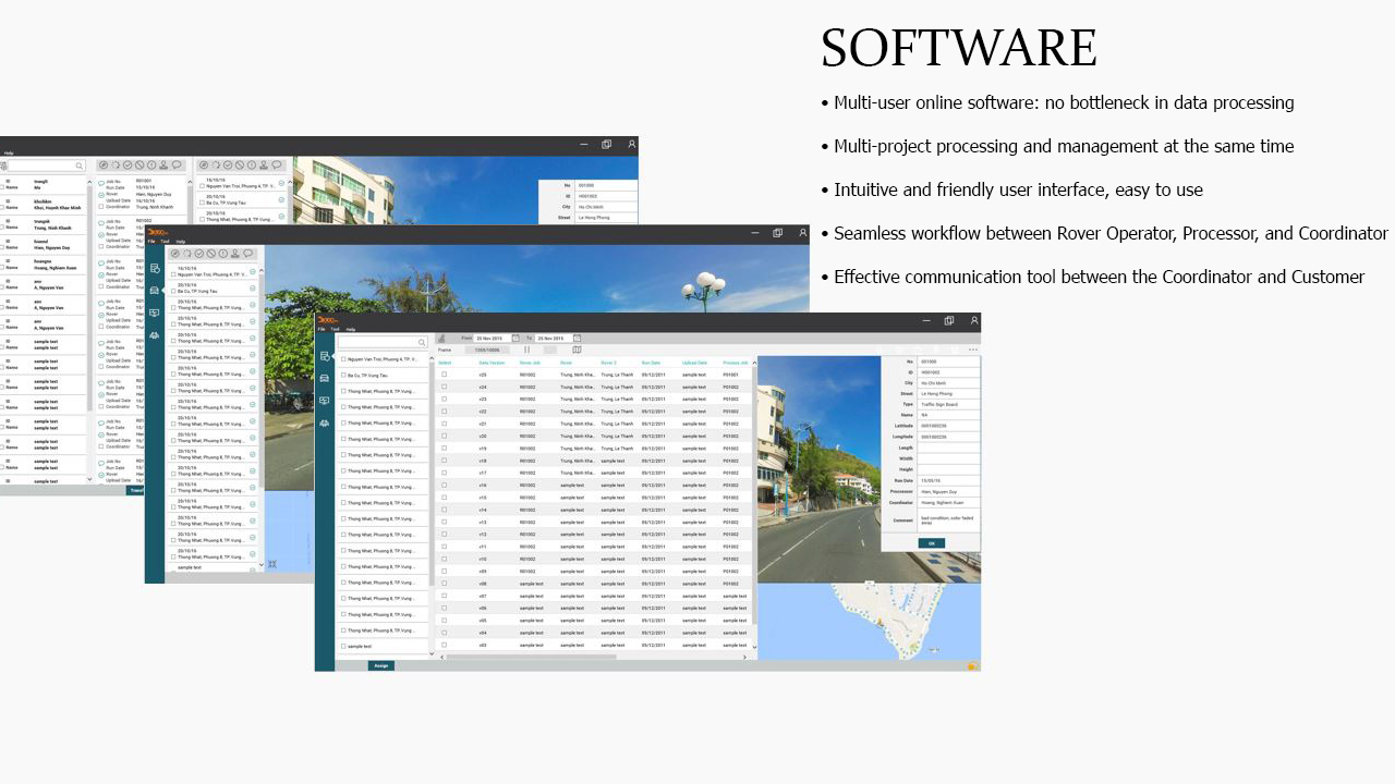
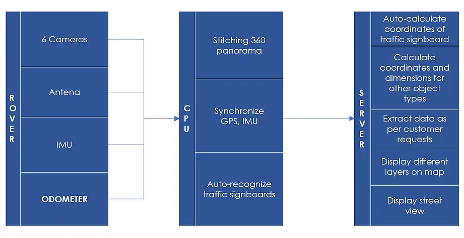
Mapdas is just a newly established company but we have spent years for researching and developing our Mobile Mapping Technology. Our Team consists of young, dynamic, and creative guys, they are experts in Electronics, Image Processing, Photogrammetry, Mechanics, and Software Development. We are the first company in Vietnam to develop a full system to collect 360 Panoramic Street Level Imaginary, GPS, IMU, Wheel Rotation signals, transfer and process them real time on our server. The Value that we offer to customers is the combination of High quality and effective cost which can completely solve customers’ problems of balancing between limited budget and the needs for quality and scope of work.
| Specification | Value |
|---|---|
| Shooting frequency | 1 Frame/ 3m |
| Picture resolution | 30 MP |
| Working temperature | Sunny condition |
| Optimal Speed | 40 km/h |
| Precision | |
| Coordinates | +- 5 (dm) |
| Length | +- 2 (dm) |
| Area | +- 4 (dm2) |
| Output format | as per customers' rquirements |
| Continuous working time | 8 hours |
| Time to charge battery | 8 hours |
| Weight | 20Kg |
| Data Output | Object name |
| Object type | |
| Coordinate | |
| Distance: Lenth, Width, Height | |
| Area |
• Rigid, compact structure
• Receive RTK-GNSS
• Self-positioning in the absence of GPS
• Auto-process images and transmit to server in real time mode.
• Quick set up and start
• Monitor and control by Mobile App
| ROAD SURVEY | ||
 | Road Survey is necessary for Technical solutions and Cost estimation before building or repairing. Mapdas Mobile Mapping System can help collect 360 street level imagery of the road and display it on the map; recognize Objects and calculate their Coordinates of Traffic Signboard, Length and Width of roads, Height of bridges... | |
| RAILWAY SURVEY | ||
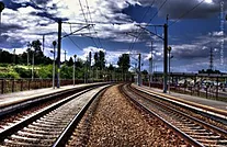 | Mapdas can be mounted on top of a train to regularly collect data of the whole railway. The software can display all 360 space so that we can identify damages, position and categorize them for repair and maintenance. | |
| WATERWAY SURVEY | ||
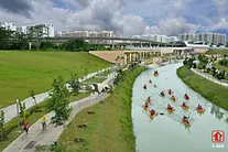 | Mapdas can be mounted on top of a ship to collect data of the water. The software can display all 360 space so that we can identify damages on the sides, position and categorize them for repair and maintenance. In addition, high resolution 360 Photos can help recognize water pollution qualitatively on a large scale. | |
| ELECTRICITY SURVEY | ||
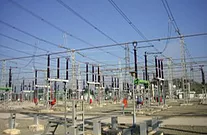 | Due to the high-risk nature of the electricity network, distant image survey is very suitable. Mapdas Mobile Mapping System let us collect images of the high-voltage network in a safe distance, reduce time on site. The software can calculate the precise coordinates of poles, categorize, and display them on map; identify parts needed for repair and maintenance, calculate dimensions i.e. length, width, height of objects. | |
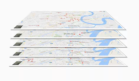
| MAP DATA COLLECTION | ||
|
Mapdas provide Map Data collection service to customers who are specialized in GIS. The outputs include: • 360 Panoramic Photos • Object Name • Category • Description • Coordinates • Dimensions: Length, Width, Height, Area |
 |
|